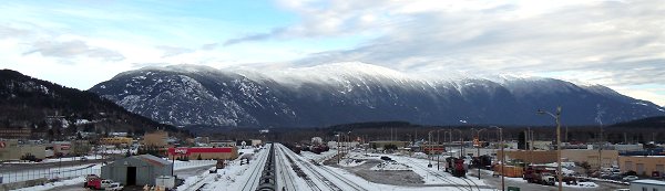
I'm standing on the railroad overpass in the center of Terrace, looking east. What you see there is Thornhill Mountain. The smaller hill to the left of the mountain is "Terrace Mountain". Behind THAT is the village of Thornhill, which is the part of Terrace that is on the other side of the river. So, "Thornhill" (the village) is north east of where I am standing. By the way "Thornhill" is the last name of a person, not a hill. The area was named after Tom Thornhill, who settled here in the 1890's. The highest peak in the center of the mountain range is over 5000 feet above sea level. The two other high peaks on the left have antenna stations on them and are accessible by a gravel service road.
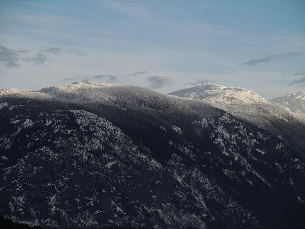
In this picture I have zoomed in on the two peaks where the radio antennas and repeaters are. The highest peak of the mountain is off to the right of these two peaks. The service road that goes to both of the the repeating stations starts way over on the right side of the mountain range and works its way gradually up to the left where the towers are. Kind of a "side hill" road. At some point a trail veers off of the road and goes to the summit. The guidebook says it's a seven hour hike (round trip) to the summit.
|
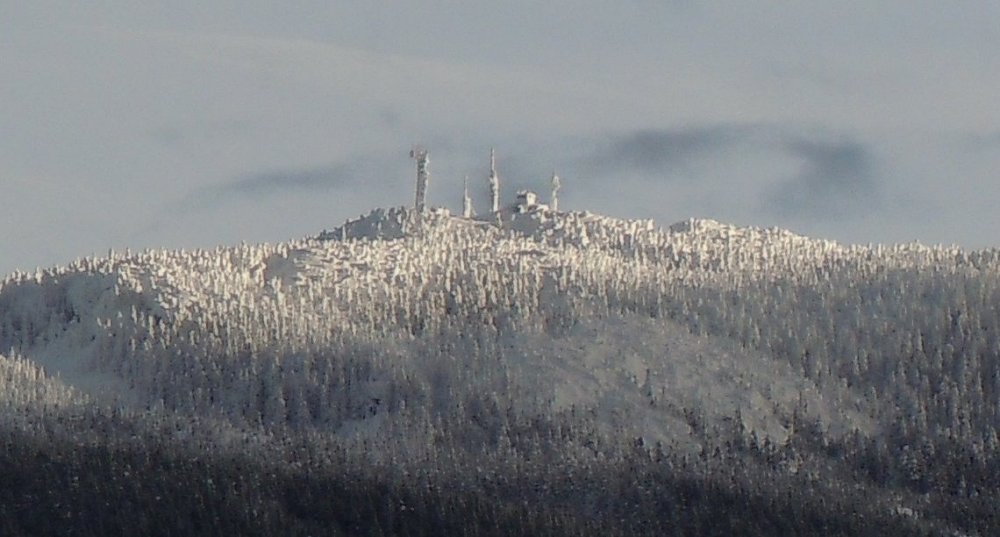
This is the peak on the left. It's like something out of a frozen fantasy movie. Ice Castles.
My brother-in-law, Larry, took me to the repeating stations last summer. By Jeep pickup, it was a two hour round trip.
I wouldn't want to go there in the winter unless it was by snowmobile.
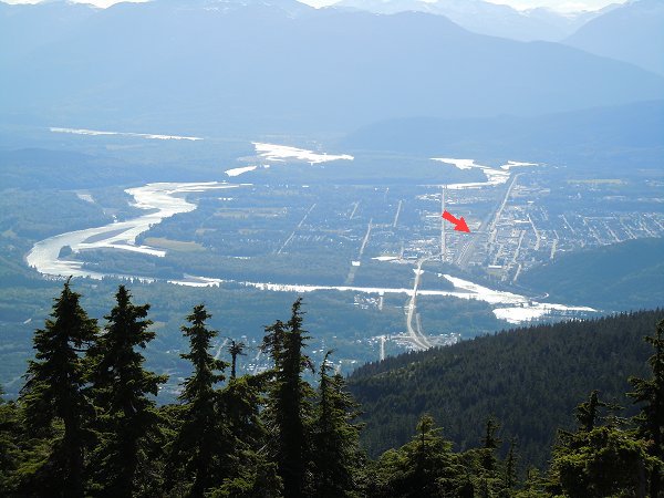
So, standing at the top of the mountain, last summer, I'm looking west and you can see the railroad overpass (red arrow) where I took the winter shots from. The city of Terrace is on the far side of the river and part of the village of Thornhill is visible on the near side.
See Thornhill Mountain from our window, HERE.
And see where in the world all of this is, HERE.
|
|